Check Availability
Our Trails

Local Discovery

Our Trails

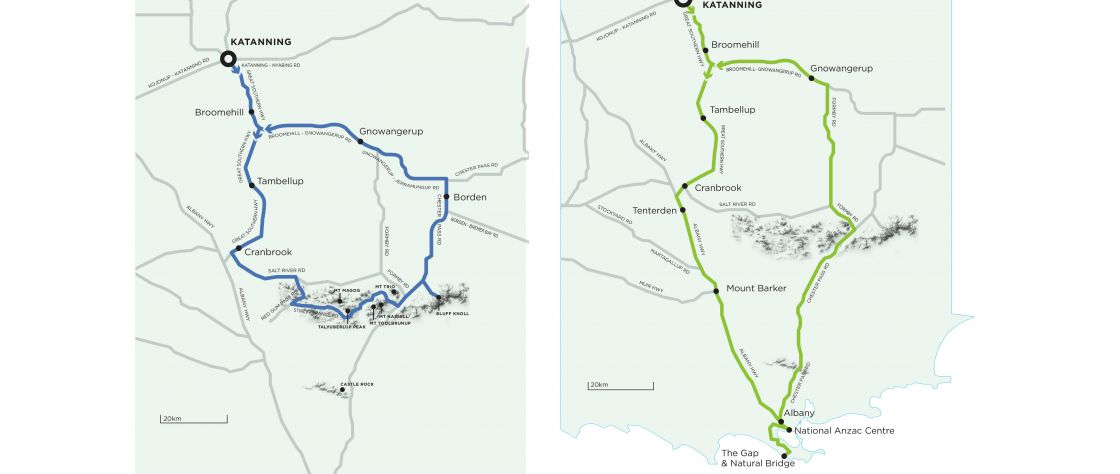
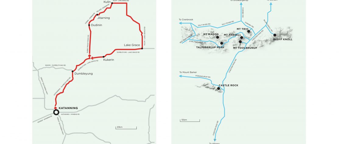
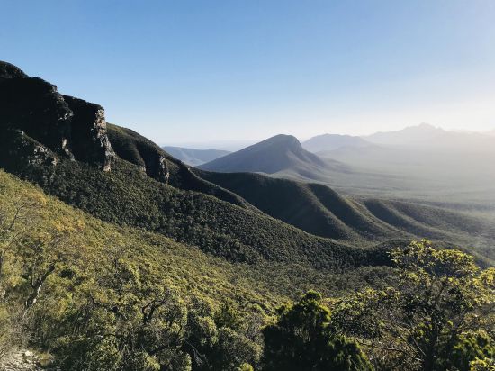
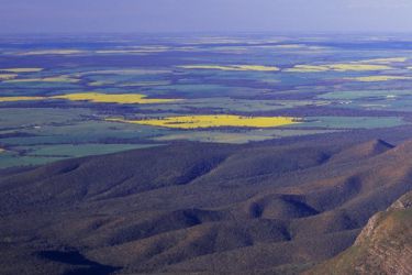
A visit to Katanning would not be complete without immersing yourself in the rich natural beauty of our neck of the woods and a dive into the history of the region. We invite you to use the Premier Mill Hotel as your hub and explore the wonders, both man-made and natural, that abound to the north, south, east and west of Katanning.

Take a trip back in time and learn about the region's rich Noongar history and culture dating back thousands of years. Visit the salt lake where Donald Campbell set the world water speed record in 1964.

Of all the peoples of the Commonwealth, those of Western Australia are most pre-eminently distinguished by the propensity for going overseas for holidays and recreation. This can only be accounted for on the supposition that our people do not really know their own country. Yet their inland great southern country compares more than favourably with any other part of Australia for its scenic beauty and intrinsic, as well as historic, interest.

The Western Mail – December 1917

Discover Katanning

If you want to stay close to your new home at The Premier Mill Hotel, you can walk, ride or take a short drive to explore what Katanning has to offer.

The welcoming spirit of this town is a testament to the townsfolk. Ask a local about the history of Katanning, they'll proudly send you out to Kobeelya House and tell you the story of Frederick Piesse who founded the town. The residents here are extremely proud to call Katanning their home, as are we.

Let us show you around our neighbourhood... Read more >

The Coast Less Travelled

The morning light, as you drive towards Bremer Bay from Katanning and skirt the north-eastern edge of the Stirling Ranges, tints even the barest stubble gold; paints even the earliest shoots after the rains bright green; reflects on the trunks of the salmon gums with a coppery pink glow that’s almost orange; and all this against the blue-grey shadowy backdrop of the ancient mountain range.

Even on a clear day, Koi Kyennu-ruff (‘mist moving among mountains’) will have the wisps of clouds around their peaks that the Goreng Noongars of the plains believed were a sign of the ancient spirits keeping watch. It’s a scene that could have been painted by Monet or Van Goh, and that was rendered lovingly on the many canvases of artist Bella Kelly. Kelly, and the many local artists she influenced, tended to paint the view of the ranges framed by two white gums... Read more >

The Mountain Wine Trail

Journey to a distinct part of the Great Southern, a little range of granite domes that not many people from Perth get to see. The Porongurups have the views, clear light and pure air of a classic hill station and the distinctiveness from their surrounds that all mountain regions seem to possess.

They rise like an island from a sea of surrounding farmland and 55 million years ago that’s exactly what they were: part of a chain of granite islands off a southern coastline of Australia that ran somewhere near the Stirling Ranges. The park is an island of biodiversity too, containing stands of Karri trees which are normally found in the higher rainfall areas further west and that are thought to have been... Read more >

The Eastern Waterholes

Look east from the Premier Mill Hotel, down Clive Street, across the valley of the town, and you can see, on the distant ridge, the last stand of jarrah trees of the South-West forests. This is the beginning of the great plains of the interior of Australia, and today’s trail will pass from the edge of the jarrah, through the southern Wheatbelt and the Mallee, and back again.

But first we travel south, to Katanning’s nearest neighbour, Broomehill, to learn about the beginning of a famous Australian outback journey.

In 1892, just four years after the completion of the Great Southern Railway, word spread of a gold find in Coolgardie. The streets of Albany, Perth and Fremantle were suddenly crowded with miners, merchants, and the rest of the fortune seekers that follow a gold rush... Read more >

A Track Back in Time

On the short drive west from Katanning to Kojonup, you’ll traverse the very beginning of the rolling hills that cross Western Australia’s south-west corner. It’s a small change in geography, but a half-century step back in time.

The Noongar people travelled this land for many thousands of years, linking water sources by dreaming tracks that were memorised in song; creating a living encyclopedia and map of their world. The first European surveyors, looking for an overland route between Perth and Albany on horseback, followed the water too; and the spring at Kojonup fed by a mostly subterranean granite dome, was an important watering stop on the track that became the Albany Highway. This staging post that grew into a military barracks near the spring was built more than fifty years before the establishment of… Read more >

The River Wine Trail

If your idea of “epic” is a relaxing morning or afternoon drive, tasting some award-winning wines, some good coffee, a nice lunch and maybe a siesta, then the river wine trail may be more to your liking. This trail crosses some beautiful country and distinctly different landforms, but on a more compact scale. Plus, there’s wine.

We start by driving across to Katanning’s closest neighbour to the west, Kojonup. We are heading for lush pastures and rich soils today, and you’ll notice the subtle change in the country as we begin to roll over the steeper hills of the south-west corner of the State. Our route takes us down the main street of Kojonup. At the bottom of the hill, just past the town centre, you’ll see a giant replica wool wagon where the Albany Highway crosses the creek. This is a little precinct that... Read more >

A Stirling Mountain Drive

The first stage of our adventure takes us south to where the two great arteries meet: road and rail. Before the Great Southern Railway was built: Katanning was an occasional sandalwood cutters camp; Broomehill was a few kilometres west (and called Eticup); Tambellup was part of a pastoral station; and Cranbrook was near a popular sheep-grazing spot called Round Swamp.

All these towns that you pass through on the way south, owe their existence to the controversial decision to take the railway inland along the edge of the plains, and not down the Albany Highway. It was a choice that changed the fate of places like Williams, Arthur River and Kojonup forever. The two trails meet at Cranbrook, near the western tip of the Stirling Ranges, which is our destination... Read more >

A Day in King George Sound

In the early 1600s, Dutch seafarer François Thijssen set sail from the Cape of Good Hope on his vessel The Golden Seahorse for what is now Jakarta, Indonesia. He missed, by quite a long way – more than 3000 kilometres. On the 26th of January 1627, he came across Australia somewhere near Cape Leeuwin.

His charts for the southern coast of what he called ‘New Holland’ show a bay and islands that were most probably Albany. It wasn’t until 162 years later, though, that Captain George Vancouver, aboard the Discovery, sailed past Michaelmas and Breaksea Islands and named King George the Third’s Sound. Vancouver stayed 15 days, explored inland, made contact with the Minang Noongars... Read more >

An Outback Mission

New settlers landing in Australia for the first time found a very strange land indeed: the trees shed their bark and not their leaves; the swans were black; it was warmer in the hills; some mammals laid eggs while others raised their young in pouches. Nostalgia for the home country could be strong, and so the Acclimatisation Society of Victoria was formed in 1861. Its purpose was to encourage the importing of animals because the local varieties seemed deficient, but also to make the place feel a little more like England. One of the society’s members was Thomas Austin, who introduced twelve rabbits to his estate in Victoria. ‘The introduction of a few rabbits could do little harm and might provide a touch of home, in addition to a spot of hunting,’ he said. He was wrong about the harm. In less than a decade the plague of... Read more >

A Walk Among the Clouds

Regardless of which climb you’ve chosen to do for the day, on the drive south, you’ll see most of the options laid out before you as the Stirling Range fills your windscreen. By numbers alone, these mountains aren’t that impressive. At 1100 meters above sea level, Bluff Knoll, the highest peak, isn’t even Western Australia’s highest mountain.

But numbers can be deceiving, and it’s the topographic prominence of over 800 metres that gives this range its towering presence. Bluff Knoll looks over the surrounding country like an impassive grey sentinel with a dark green cloak pulled around its shoulders. The Goreng Noongars of the plains, who wore kangaroo skin cloaks around their shoulders in the winter months, called it Bular Mial, which means “many eyes”: an ancestral being, watching over all.… Read more >